

-
News
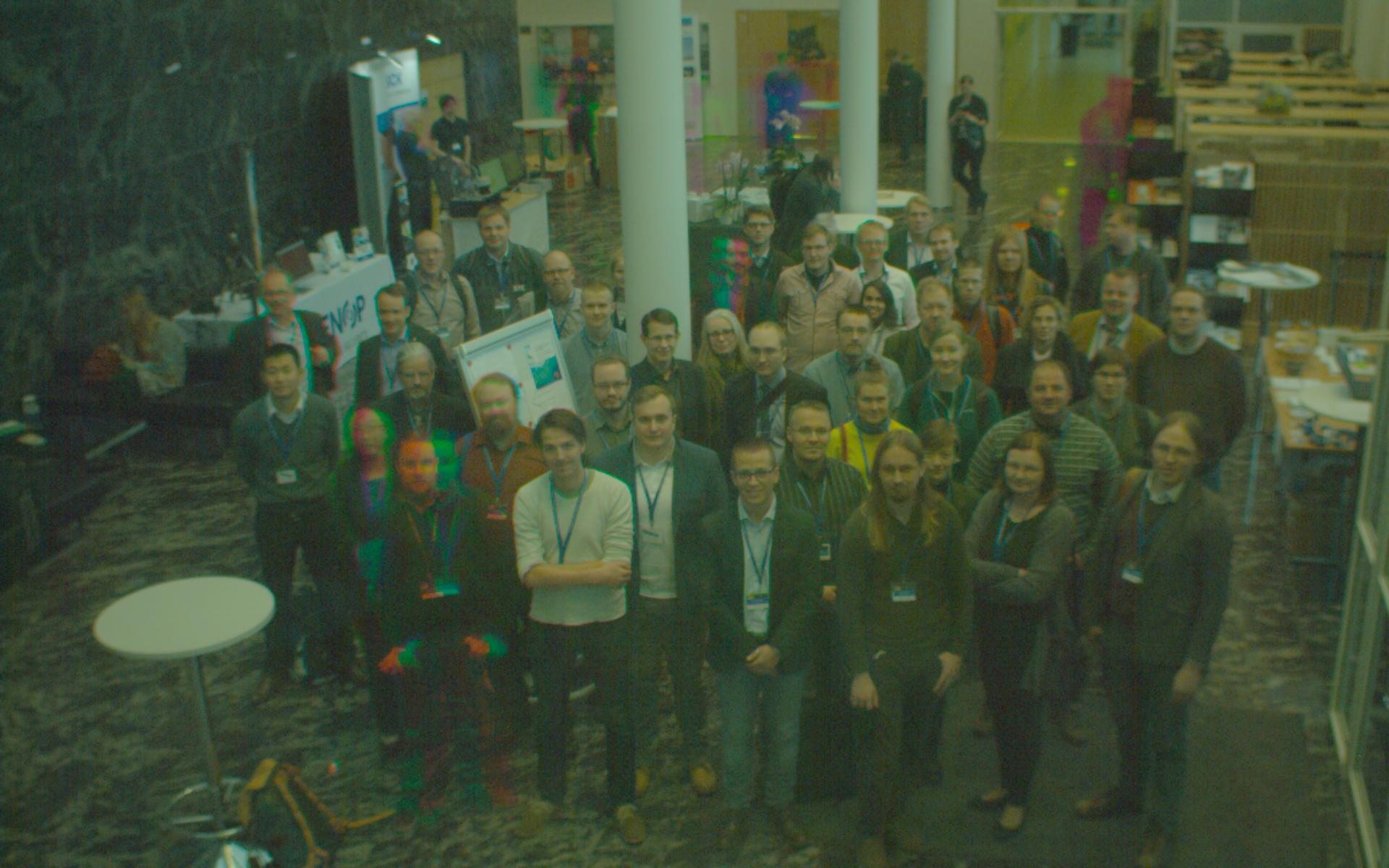
- ● Hyperspectral group photo (as a animation, 19MB, gif)
- ● Conference presentations (128MB, zip)
- ● Conference papers published online: link
- ● Program is published
- ● Hyperspectral group photo (as a animation, 19MB, gif)
-
Event background
Spectral imaging and 3D sensor technologies have developed explosively in recent years for a variety of geospatial applications. The integration of multi-modal information both in 2D and 3D enables the automation of several processing, analysis and interpretation tasks based on spatial, spectral, temporal features. New cutting-edge hardware and software solutions have a significant impact on current challenging geospatial applications. To this end, this 3-day workshop (ISPRS SPEC3D) will gather together top scientists and leading industry partners to share the state-of-the-art and their vision for future advances.
The main objectives of ISPRS SPEC3D include (but are not limited to):
1) to share knowledge of development trends in spectral and 3D sensing technologies,
2) to highlight any requirements for future developments in the data processing technologies,
3) to discover new prospects in exploiting the current emerging technologies in existing and new application fields, and
4) to improve knowledge transfer and cooperation between the industry and research/academia.The program will include several keynotes from leading, influential, recognised scientists, demos and presentations from the industry, as well as oral and poster presentations after peer review.
ISPRS SPEC3D is jointly organized by the ISPRS working groups
- ● WG III/4: Hyperspectral Image Processing
- ● WG III/1: Thematic Information Extraction
- ● WG I/5: New 3D Sensors for Metrology and Industrial Vision
- ● WG I/1: Multi- and Hyperspectral Sensing
- ● WG II/7: Vision Metrology
-
Aims and scope
ISPRS SPEC3D focuses on various emerging topics on novel sensors, data processing and analysis, thematic information extraction, and geospatial solutions, including (but not limited to):
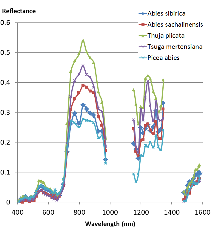
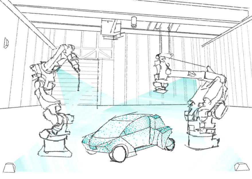
1) New aspects of sensors, systems and calibration: spectral imaging, LIDAR, micro-LIDAR and -RADAR, low-cost 3D sensors, different platforms (aerial, UAV, robotic, mobile, portable, etc.), and geometric and radiometric sensor and system calibration.
2) Processing and interpretation requirements for novel spectroscopic and 3D data, including aspects of automation, fast response and real-time processing, georeferencing, radiometric calibration, multisource data fusion, multitemporal and video data analysis, time-series and change detection, context awareness, big data, and crowd sourcing.
3) Geospatial solutions utilizing the new sensors and data, such as mapping and monitoring in natural and built environments, forestry and agriculture, biodiversity, industrial and civil applications, robotics, and virtual and augmented reality.
-
Contact
eija.honkavaara@nls.fi (Workshop chair)
ilkka.polonen@jyu.fi (Local organization) -
Location / Venue
Frontiers in Spectral imaging and 3D Technologies for Geospatial Solutions –workshop is held in Agora Building at University of Jyväskylä’s Mattilanniemi Campus (Mattilanniemi 2). The building is situated in a scenic position by Lake Jyväsjärvi, within easy walking distance from the main hotels and travel centre. The auditoriums, meeting rooms and university restaurant are all under the same roof.
 Agora
Agora
Faculty of Information Technology
P.O. Box 35 (Agora)
FI - 40014 University of Jyväskylä
Finland
Platinum sponsors
Gold sponsors
Silver sponsors
In collaboration with
